Skip to content

Posts from the ‘California’ Category

McArthur-Burney Falls State Park and the Pacific Crest Trail

The plan yesterday morning was to visit McArthur-Burney Falls Memorial State Park (MBFMSP), which is located about 20 minutes from our current BLM location.  MBFMSP is California’s second oldest state park, its main attraction being the whitewater falls of Burney Creek.

Anticipating holiday weekend crowds, we arrived around 9am which is crazy early for park standards.  The combination of a Sunday morning and campers operating on “park time”, things were eerily quiet while we had trails and other popular lookout points mostly to ourselves.   Like most large parks, there are a few “must see” attractions at MBFMSP.  Here, the main event is the waterfall and I understand why.  Unlike many waterfalls, the majority of the water does not ‘fall’ over the edge.   Rather, a significant amount of water is routed through underground channels which end abruptly at the wall of the falls, sending 100 million gallons daily cascading below.

Water descends 129ft at Burney Falls.

Water descends 129ft at Burney Falls.

The popular Burney Falls loop trail seems to be a common route for most visitors – it is short, focused on the falls, and conveniently located to the parking lot.  Seeking a bit more walking, we opted for the lengthier trail which continues another 1.5(ish) miles towards Lake Britton.

The river trailer to Lake Britton

The river trail to Lake Britton

Lake Britton

Lake Britton

As was the case earlier this weekend, all this calm water had me bemoaning my lack of canoe or kayak.  A park concessioner does offer rentals, but the steep fees coupled with our time constraints quickly squashed any illusions of a morning paddle I had swirling in my head.

Suffice it to say, we continued to walk.

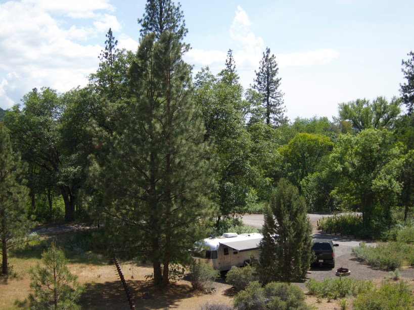
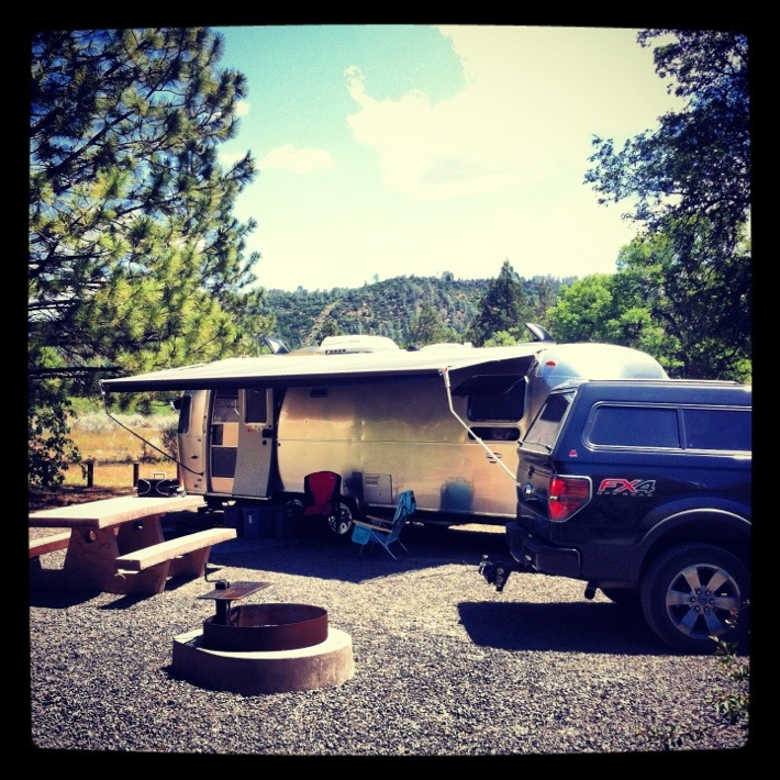
Returning from the lake, we chose to continue back to the truck by way of the main park road.  Because the park was so empty, we enjoyed a nearly car-free saunter, making a point to enjoy our surroundings as we viewed the area.  Eventually we reached the main campground, which only served to reinforce how fabulous our BLM location was in comparison.  Unlike this relatively crowded state park, our 10-acre campground contained only 7 sites (plus one for the host).

Kelly, preparing for dismount

Kelly, practicing her balance routine

Kelly not sticking the landing

Kelly missed the landing

On a whim, we decided to visit the General Store before leaving the park.  Not surprisingly, the selection was mostly junk, but I was struck with the beauty of a handmade bench outside the main door.  Too awesome to be sat upon, I could only reflect on its exquisiteness.

The bench of all benches

The bench of all benches

As a general rule, dogs are not allowed in California state parks … at least not on any of the interesting trails (yet another reason this state drives me crazy).  This being the case, following lunch back at the trailer, we made plans for an afternoon hike with Lilly – our destination being a trailhead along the Pacific Crest Trail.  For those who don’t know, the PCT is a single continuous walking pathway extending through the states of California, Oregon, and Washington.

Other than its close proximity to our camping site, the section we visited wasn’t anything overly impressive.  It seems that the more time we spend in nature, the higher our expectations bar continues to rise.  Oh how we’ve come so far.  Back when we were living in Chicago as urban condo dwellers, I’m quite certain Kelly and I would have found this particular trail to be amazing.  Now it is simply a nice location to walk the dog.

That said, we love being outdoors and time spent in nature’s playground is always a precious treat.

Wild flowers in bloom along the Pacific Crest Trail

Wild flowers in bloom along the Pacific Crest Trail

Relaxing and snacking

Relaxing and snacking under the shade-cover

Overlooking the Pit River Valley

Overlooking the Pit River Valley

Transporting hydroelectricity   power from the Pit River

Transporting hydroelectricity power from the Pit River

On the Road Again

Once again Kelly and I are on the road; our second trip in as many weekends.  Following a quick work week in Half Moon Bay, last night after dinner we hitched-up Mabel and began venturing northeast, driving about 90 miles, enough to be fully beyond the reaches San Francisco metro traffic.  We’re headed towards southern Oregon where we will be meeting-up with friends in a few days, but not before we partake in a bit of dry camping on BLM land.

We awoke this morning, not knowing were we would land for the weekend.  This being the case, Kelly commenced a bit of internet research while I was driving and fairly quickly decided that Pit River Campground would be our ideal location for two nights.

Pit River Campground entrance sign

Welcoming us to the campground

Like most BLM sites, this campground is low on amenities, but flush with nature and is very peaceful – just what we wanted.  There are only seven sites in the campground, each secured on a first-come, first-serve basis.  We chose a site with full sun then quickly got ourselves situated.

Our site

Our site

Interestingly, even on this long holiday weekend not all sites are taken.  A major State park offering 128 campsites is located about 20 miles away and I suspect most of the crowds chose to park themselves there, which is fine with Kelly and me.  Btw, the fee here is $8 per night.  Our friends 20 miles down the road are paying four times that, plus online booking fees.

Our site from above

Our site from above

Following a quick lunch, we took Lilly for a walk which also served as reconnoissance of the immediate area.  Unless you are keen to fly fish, there’s not too much to do or see within the campground.  That said, the water is quite nice and left me yearning for a canoe – although in this section of the river a kayak is probably a better option.  When the day comes that we hit the road as full-timers, I will be lobbying hard for a canoe.

Banks of the Pit River

Banks of the Pit River

Pit River from above

Pit River from above

WiFi connectivity is fabulous here.  Tethering my iPhone, I pull five bars (-69db) of AT&T at 3G speeds when using my Wilson Sleek (three bars without amplification).  Sadly, the Verizon signal is just ok, which is too bad because 4G LTE speeds would be a luxury.  Regardless, I’ve been streaming music all afternoon and evening with no problems and these blog pictures are uploading quickly enough.  I will definitely keep this location in mind the next time Kelly and I decide to work remotely for a few days.

Speaking of the quick internet connectivity, I spent a bit of time online after dinner and found a few places to explore tomorrow, ensuring we’ll have plenty to keep us busy.  Uninterested in my web browsing, Lilly was instead infatuated with all the critters outside.  I think she would have willingly jumped through the window if not for the screens.

Lilly, watching squirrels

Lilly, watching squirrels

At one point, Lilly moved to the bedroom windows, allowing me to make a play for the couch.  She was not pleased to lose her place and as evidenced within the image below, was determined to minimize my enjoyment of any relaxing.

Lilly, undeterred

Lilly, 100% in my way

I’ll probably cement my revenge by denying her dog treats tomorrow.

Pit River Campground

We’ve arrived to Pit River Campground, a BLM site in Northern California, this spot is our home for the next two nights.

20130525-140236.jpg

Well Rested

I chose not to write anything yesterday as Kelly and I were strictly observing a proper day of nothing.  Squeezed in between Lilly walks, we mostly did a lot of nothing … the highlight of the day being my lengthy afternoon nap. Unlike yesterday, our plan today called for a quick morning walk before prepping Mabel for her return home to Half Moon Bay.  The campground we were staying at is located at the far southern end of the park.  There are a number of trails scattered throughout the broader park itself and our plan this morning was to complete a four mile loop located at the far northern tip of the park boundary.  As an added bonus, the trail is also situated atop the highpoint and offers a nice view of the surrounding areas.

Looking west over the town of San Martin

Looking west over the town of San Martin

The trail starts at the Coyote Dam, built during 1935-36 as a WPA effort.  Today, the dam overlooks the mostly recreational lake and is open to any pedestrian interested in walking along the topside.

Coyote Lake placard

Coyote Lake placard

Moving towards the trail – which starts off easy enough – we were greeted by the warning sign below:

Warning sign at the trailhead

Warning sign at the trailhead

We never did encounter any Mountain Lions or Babcats, but did see a lot of cows and a few wild turkeys.

Approaching cows

Approaching the cows

A lone turkey

A lone turkey

Anticipating hot temperatures and having read the trail lacked any significant shade, we got an early start.  The absence of shade and very little breeze propelled hot temperatures, but Lilly didn’t seem to mind too much as there were numerous gopher holes to stick her nose into.  As usual, she found nothing.

The rolling hillside

The rolling hillside

Lilly waiting for me

Lilly waiting for me

Following our hike, we had to hustle in order to pack-up the trailer in advance of the 1pm check-out.  Sadly, our relaxing weekend was ending … it was time to go home and begin thinking about the looming workweek.   Dang.