Skip to content

Posts from the ‘On the Road’ Category

Mt Madonna County Park

This past weekend, Kelly and I used the holiday weekend as an opportunity to put some miles on the Airstream and escape to Mt Madonna Count Park.  Located about two hours south of HMB and nestled in the midst of a forest of Redwoods, the park seemed like a must visit spot.

Knowing the holiday weekend would likely draw big crowds, we decided to arrive Thursday afternoon in hopes of enjoying some quiet … a bit of calm prior to the storm’s arrival.

DSCF0020

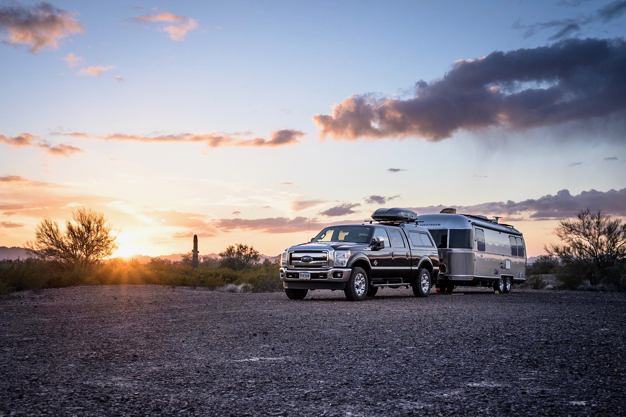
Our sweet corner spot #104

When booking the reservation, I tried to pick a spot that looked to be the most private.  Often, campground reservation systems can be misleading, making it difficult to know what type of site to expect, but I was pleasantly surprised upon arrival.  Our spot was very private, which coupled with my not so welcoming placement of the truck, did a fantastic job of completing the “please do not disturb” vibe we were looking to passive-aggressively establish.

A 3,688 acre county park, Mt Madonna is dominated by the giant redwood trees typical of the Santa Cruz Mountain range.  On an otherwise hot and sunny Labor day weekend, the tree canopy provided nearly 100% shade coverage which kept temperatures cool and the outside lounge time quotient high.

Internet connectivity was a bust, but I did ok with limited over the air TV reception … the onset of college football being an added bonus.

Big trees at the campsite

Big trees at the campsite

TV time

TV time

DSCF0066

Lilly on the move

The park contains miles and miles of shaded, rolling terrain – perfect for long dog walks.  The trails are well maintained and provided loads of exploration opportunities.

Kelly also tried to find time for catching-up on yoga, but Lilly had other ideas.

DSCF0068

DSCF0055

DSCF0076

DSCF0081

During one of our walks, we visited the ruins of the summer home of Henry Miller, one of the largest cattle barons in California history.  Born in Germany, Miller immigrated to New York in 1846 (during his 20’s) with only $6.  By 1858 Miller had migrated to San Francisco and built a thriving butcher business.  Shortly thereafter, Miller and his business partner shifted emphasis from meat products to cattle raising, and soon became the largest cattle rancher in California and one of the largest landowners in the United States – owning 1.4 million acres and controlling nearly 22,000 square miles of cattle and farm land in California, Nevada, and Oregon.  At the time of his death, Miller was worth an estimated $40 Million.

DSCF0043

Remains of the ballroom

Wandering the remains, I had a sense of familiarity – something about this place felt odd.  I was convinced that Kelly and I had been to this park before, but I couldn’t remember a details.   Initially, Kelly thought I would cuckoo but I insisted that we’d been here previously.  Once back at the camper I checked my email archives and confirmed what I had suspected … we’d been there in April 2012 in our previous camper, only three sites down (#101).

I’m still not sure how it was we didn’t immediately recall the previous visit.  But memories of this visit (and the accompanying documentation) should last for a while.  Mt Madonna is a great park close to HMB and I’m sure we’ll be back.

Avoiding Groundhog Day

A year ago Kelly and I completed our longest tow day ever – 11 hours on the road only to go nowhere.  I’ve detailed events of that fiasco previously, but suffice it to say, I do not advise towing a fully provisioned trailer along a very crowded HW1 on the 4th of July, especially without a campground reservation securely in hand.

Determined not to make that same mistake this year, Kelly and I finalized holiday weekend reservations at Pinnacles National Park well in advance.  This would be our second visit to America’s newest national park and our plan was to spend a few relaxing days hiking the trails we didn’t complete during our visit last fall.

Knowing the weather would likely be hot, our plan was to be on the trail by 7am each morning in order to be back at the trailer a few hours later, before temperatures rose to triple digits.  Just as planned, the following morning we arrived to the trailhead around 8:30am.

Bathroom at the trailhead

Bathroom at the trailhead

I’d categorize the first trail as ‘ok’.  The trail took us through rolling sections of tree cover and skirted some cool ravine areas before arriving to sketchy  stairs carved into a rock face leading to a giant reservoir … which as far as I could tell, was inhabited mostly by snakes, frogs, and turtles.  But mostly, the trail lacked in ‘wow’ factor.  Perhaps I’m starting to become spoiled with the abundance of ‘wow’ scenery in California, but for me, this hike – while certainly pleasant, wasn’t the best I’ve seen, nor the best the park has to offer.

DSCF9601

Headed over there somewhere

DSCF9603

Kelly pauses for a look

DSCF9604

climbing up towards the reservoir

DSCF9619

Reservoir low on water – another victim of the severe drought conditions

DSCF9612

Lots of snakes relaxing under the warm sun

DSCF9617

Pinnacle rock formations

Day 2 started off a bit better – that is to say we arrived to the trailhead by 8am, but still sufficiently late for our 7am target (hey, it’s vacation, cut us some slack please).  Anyway, our plan was to complete one of the larger loops which would take us to what one park ranger referred to as the “money shot” section of the park.  Having seen the western side of the park during our last visit, I concur with the spirit of his comment – the area is stunningly beautiful, but I would prefer that ranges refrain from describing anything as being a money shot when conversing with me.

The weather seemed to be warmer than the day prior, and with no cloud-cover in sight, we knew to expect high temperatures for much of this unshaded hike.  However, before we would face any of the high heat, we first had to navigate through one of the park’s three caves.  Technically, these are not caves per se, rather  hundreds … perhaps thousands of boulders which have toppled onto themselves, creating a cave-like effect.  The result is a section of trail that is completely dark, damp, and very cool (temperature-wise).  Oh, and a lot of fun.

The park literature and signage approaching all of the park’s caves strongly advise the usage of a headlight(s).  Myself, I cannot imagine attempting to navigate the caves without lighting, but I’m sure some dumb-ass has tried.

DSCF9626

Approaching the cave

Just inside the cave, looking back towards the entrance

Just inside the cave, looking back towards the entrance

The picture below was taken using a flash, but trust me, it’s absolutely dark in these caves.  Note the guide arrow (pointing to the right) above Kelly’s left hand.  Also, check out the size of the boulders – they are  huge!

Kelly, cautiously making her way forward

Kelly, cautiously making her way forward

Dave descending into the 2nd set of caves

Dave descending into the 2nd set of caves

Once through the cave section, the trail winds through a series of giant boulders and other rock faces before opening onto an expansive meadow.  We then connected to a trail that winds atop some of the higher points (2500-ish feet) of the park, affording fantastic views.  Total hike was about 8.5 miles.  July isn’t the best time to visit – it’s crazy hot, dry, and much of the plant life is burnt to a crisp.  With better planning on our part, I would expect springtime to be glorious … wild flowers blooming everywhere.

DSCF9643

BIG rocks wedged everywhere

DSCF9645

Transitioning from caves to meadows

DSCF9648

DSCF9649

DSCF9653

More pinnacles as we hike towards the highpoint of the trail

DSCF9657

DSCF9661

Not long after we returned to the trailer, the air conditioning failed.  Quickly, the inside temperatures of the Airstream soared to a sweltering state, but we managed to make the best of the situation … including Kelly’s usage of an ice pack to cool her aching head.

DSCF9663

DSCF9664

Turns out that the failed AC was caused by a tripped GFCI bathroom breaker … probably due to heavy load.  Foolishly, I failed to consider this simple fact as part of my troubleshooting, so we had no choice but to sweat it out with many others for hours until the temps broke.  Fortunately, I did notice GFCI after work today (Monday), which was easily reset with the push a button.

So it turns out the misery you see in the photo above could have easily been avoided had I noticed tripped outlet.  Sorry Kelly.


The Joy of Dumb Luck

For the past few days, Kelly and I have been relaxing in a national forest just outside the small town of Mt Shasta, which is located in far northern California.  The town sits in the shadows of its namesake – Mt Shasta volcano (elevation 14,197 ft).

Looking east towards Mt Shasta

Looking east towards Mt Shasta

Having driven past the mountain many times, we’ve often admired it from the car, but have never stopped until this week.  The mountain happens to sit in the midst of the Shasta-Trinity National Forest, the largest forest system in California.  Combined the mountain and the high elevation forest seemed like a combination we felt would make for a nice resting place for a couple of days.

It was me who picked Fowlers Campground as our landing spot.  And I didn’t have much time to complete a lot of advance research … so if the place sucked, it would be me to blame.   As luck would have it , the past couple days here have been fantastic.

Sometimes a guy is just lucky.

S0739260

Wednesday, we arrived to a mostly empty campground … it’s primitive, has two loops with roughly 18-20 spacious sites per.  Not sure what the crowds would be like through the weekend, we opted for a site off to itself and with the added bonus of a spacious grassy area opening up to a hillside.

Now, having seen the entire campground now in more detail, I think we have the best location … and Kelly deserves all the credit, as I was thinking about another one elsewhere.  As an added bonus, our spot is proving to be a great point of entry for deer and other forest critters … which has provided plenty of excitement for Lilly.

Our site

Our site

Lilly keeping an eye on things

Lilly keeping an eye on things

There is nice river with three waterfalls near the campground.  Conveniently, our site is adjacent to a connector trail which links all three.  We’ve seen two waterfalls thus far, and plan to view the third before leaving in a couple days.  The trails here are nice and since this is a national forest, dogs are welcome on-leash – not so in California State or National Parks.

Once the trailer was set-up, we went out to find the “Middle Falls”, the closest of the three to our location.

S0129267

The trail to Middle Falls

S0159272

The trail to Middle Falls

Middle Falls below…

S0219281

Stopping to admire Middle Falls

This morning (Thursday) we went looking for Lower Falls, which made for a great morning hike – this one following the river.

S0249191

S0259192

The river is a local favorite for fly fishing, and provides plenty of access points to the water.  Lilly wasn’t interested in the fish, but could not get enough of the rocks – climbing all over them (and only slipping into the water a few times).

S0339209

S0399216

Eventually, we arrived to Lower Falls (above).  While this particular falls is not much of an attraction per se, the general area is gorgeous.  It’s so nice to be back at high elevation and in amongst the trees.

S0509229

Eventually, we began making our way back to camp.

S0469223

Along the way, I wanted to grab some firewood and decided to split this felled tree with my knee.

S0769265

S0539233

Upon arrival back to camp, it was time for lunch.  The remainder of the day was spent … lazy.

Almost Perfect

Some days are damn near perfect; today was one of those days.

As hoped, this side trip detour of ours to Coyote Lake Campground has been time (and $24 in campground fees) well spent.  As all the elements of a relaxing day fell into place, Kelly and I took full advantage of 73 degree temperatures and a mostly empty campground.

Following an extended night’s sleep, I ventured outside the trailer this morning to find that we had a new neighbor a few sites away.  To his or her credit, they didn’t make a peep setting-up last night … which is much appreciated.

IMG_8001

Under clear blue skies, we ventured out for a morning hike.  Our 3-hour loop trail took us through some rolling hillsides before ascending atop the main ridge-line, and back down again through more rolling hills, and ultimately back into the campground.

Given today’s glorious weather and it being the weekend, the trails were a bit more crowded than yesterday, but nothing I should complain about.  Like us, people seemed thrilled to be outside, enjoying themselves in this lovely park.

IMG_8007

IMG_8005

IMG_8028

IMG_8025

The smog and haze around this part of California can be intense.  Amazingly, just on the other side of the ridge-line, as we crested the top, the views were terrible.  There is also a massive draught crushing the state which also contributing to the miserable haze.  It hasn’t rained in months; consequently, dust and other micro-sized elements linger airborne, exacerbating the problem.

IMG_8027

 Quickly enough, we made our way back to the “clean” side of the valley and began our descent through the cover of trees and back to the trailer.

IMG_8029

IMG_8041

Look closely at the photo above and you will see our lovely home basking under full sun.  More and more, I am loving the solar panels I installed this summer.  It’s so convenient to know the house batteries are quietly sipping energy while we are out playing.

Returning to the Airstream, we had a mostly lazy afternoon and evening.  We both did a bit of work this afternoon, but not too much such that it took away from our day.

Hey … almost perfect.